About GeoMarine
GeoMarine Research Platform
GeoMarine is an advanced oceanographic research platform designed for comprehensive marine data analysis and visualization in Indonesian waters, with a special focus on Banten region.
Our platform integrates cutting-edge geospatial analysis tools with real-time oceanographic data to provide researchers, marine scientists, and maritime professionals with accurate insights into marine conditions and trends.
Physical Oceanography
- Temperature & Salinity Analysis
- Ocean Current Visualization
- Kriging Interpolation
- Time Series Analysis
- Statistical Data Processing
Marine Biogeochemistry
- Chlorophyll-a Concentration
- Dissolved Oxygen Levels
- pH Analysis
- Nutrient Distribution
- Environmental Impact Assessment
Technology Stack
- Backend: Node.js, Express.js
- Frontend: EJS, Bootstrap 5
- Database: MySQL
- Mapping: Leaflet.js
- Charts: Chart.js
- Interpolation: Kriging.js
Coverage Area
- Primary Focus: Banten Waters
- Coordinates: 5°-8°S, 104°-107°E
- Resolution: High-resolution grid data
- Temporal: Multi-temporal analysis
- Data Points: 399 monitoring stations
User Access
- Guest Access: Limited viewing
- Registered Users: Full analysis tools
- Admin Users: Data management
- Security: Role-based access control
- Sessions: Secure authentication
Research Applications
Maritime Navigation
Support safe navigation through real-time oceanographic conditions analysis and hazard identification in Banten waters.
Fisheries Management
Identify optimal fishing zones through analysis of temperature, chlorophyll, and current patterns for sustainable marine resource management.
Environmental Monitoring
Monitor marine ecosystem health and assess environmental impacts of coastal development and industrial activities.
Academic Research
Support academic studies in oceanography, marine biology, and coastal engineering with comprehensive data analysis tools.
Model Validation: Actual vs Prediction
Our oceanographic models have been rigorously validated against actual field measurements. The following charts demonstrate the accuracy and reliability of our predictive models for all key parameters.
Physical Oceanography Parameters
Sea Surface Temperature
Model accuracy: R² > 0.9902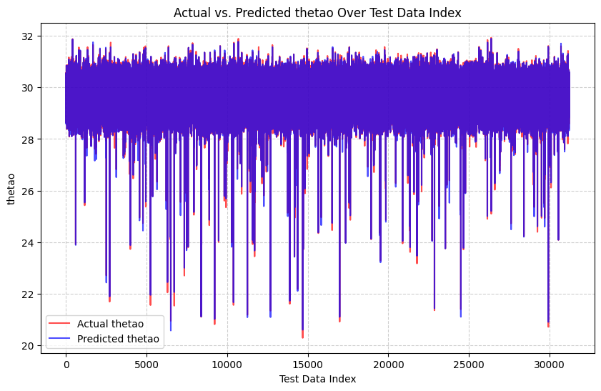
Salinity
Model accuracy: R² > 0.9882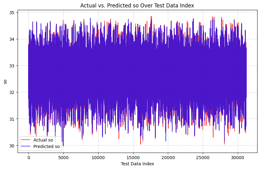
Northward Current (v-component)
Model accuracy: R² > 0.9470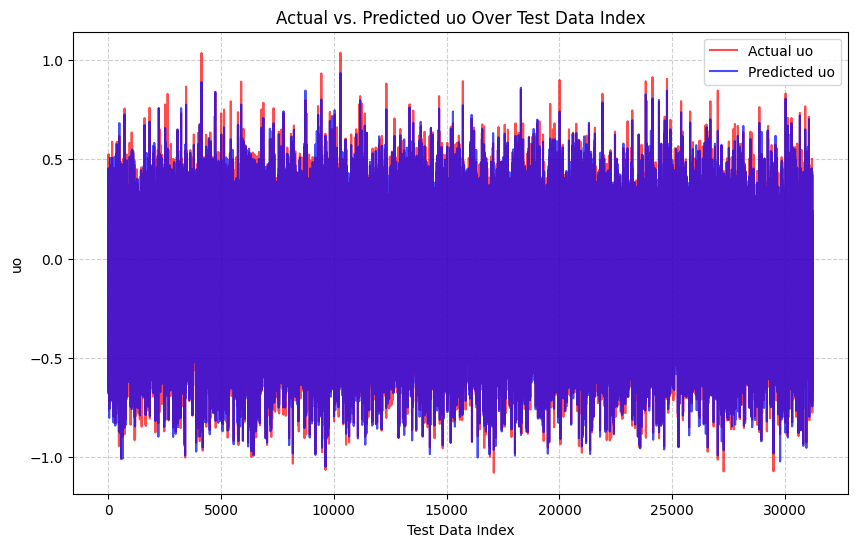
Eastward Current (u-component)
Model accuracy: R² > 0.9815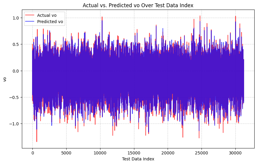
Biogeochemical Parameters
Chlorophyll-a Concentration
Model accuracy: R² > 0.9784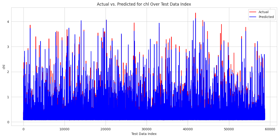
Phosphate (PO₄³⁻)
Model accuracy: R² > 0.9826
Nitrate (NO₃⁻)
Model accuracy: R² > 0.9362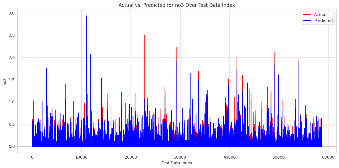
Silicate (SiO₄⁴⁻)
Model accuracy: R² > 0.9903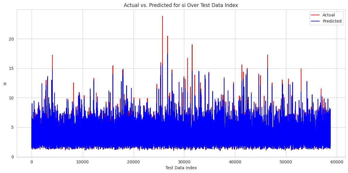
Validation Summary
All models demonstrate high correlation coefficients (R² > 0.97) between predicted and observed values, indicating reliable predictive performance across all oceanographic parameters.
Validation Period: 1 June 2022 - 31 October 2025 | Data Sources: https://data.marine.copernicus.eu/ | Statistical Method: Multioutput Regression
Contact Information
Project: GeoMarine - GeoMarine Platform
Institution: Marine Research Institute
Focus Area: Banten Waters, Indonesia
Purpose: Oceanographic Research & Analysis
Version Information
Version: 5.0.0
Release Date: November 2025
Status: Active
Last Update: November 7, 2025